Unlock the Secrets of Your Land with Web Soil Survey
Are you planning a garden, developing land, or managing agricultural fields? Understanding your soil is paramount. The Web Soil Survey (WSS) offers a powerful, free, and readily accessible tool to unlock the hidden characteristics of your land. This comprehensive guide will delve into the depths of WSS, providing you with the knowledge and expertise to effectively utilize this valuable resource for informed decision-making. We’ll explore its features, benefits, and real-world applications, empowering you to make the most of your land.
What is the Web Soil Survey? A Comprehensive Overview
The Web Soil Survey (WSS) is a digital platform developed and maintained by the United States Department of Agriculture’s (USDA) Natural Resources Conservation Service (NRCS). It provides access to a vast database of soil information, including soil maps, soil properties, and interpretations for nearly all areas in the United States and its territories. Unlike traditional paper soil surveys, WSS offers a dynamic and interactive experience, allowing users to easily explore soil data for their specific area of interest.
WSS represents a significant advancement in soil science accessibility. Before its inception, obtaining soil information often involved contacting local NRCS offices or poring over printed soil survey books. WSS democratized access to this critical data, empowering landowners, farmers, developers, and researchers to make informed decisions based on site-specific soil characteristics.
At its core, WSS relies on decades of soil survey work conducted by NRCS soil scientists. These experts painstakingly map and characterize soils across the landscape, identifying different soil types (or “soil series”) based on their physical, chemical, and morphological properties. This information is then compiled into a digital database and made accessible through the WSS platform.
Navigating the NRCS Web Soil Survey: A User-Friendly Guide
The NRCS Web Soil Survey (WSS) website is a powerful tool, but navigating it effectively is key to unlocking its potential. Here’s a breakdown of its core functions and how to use them:
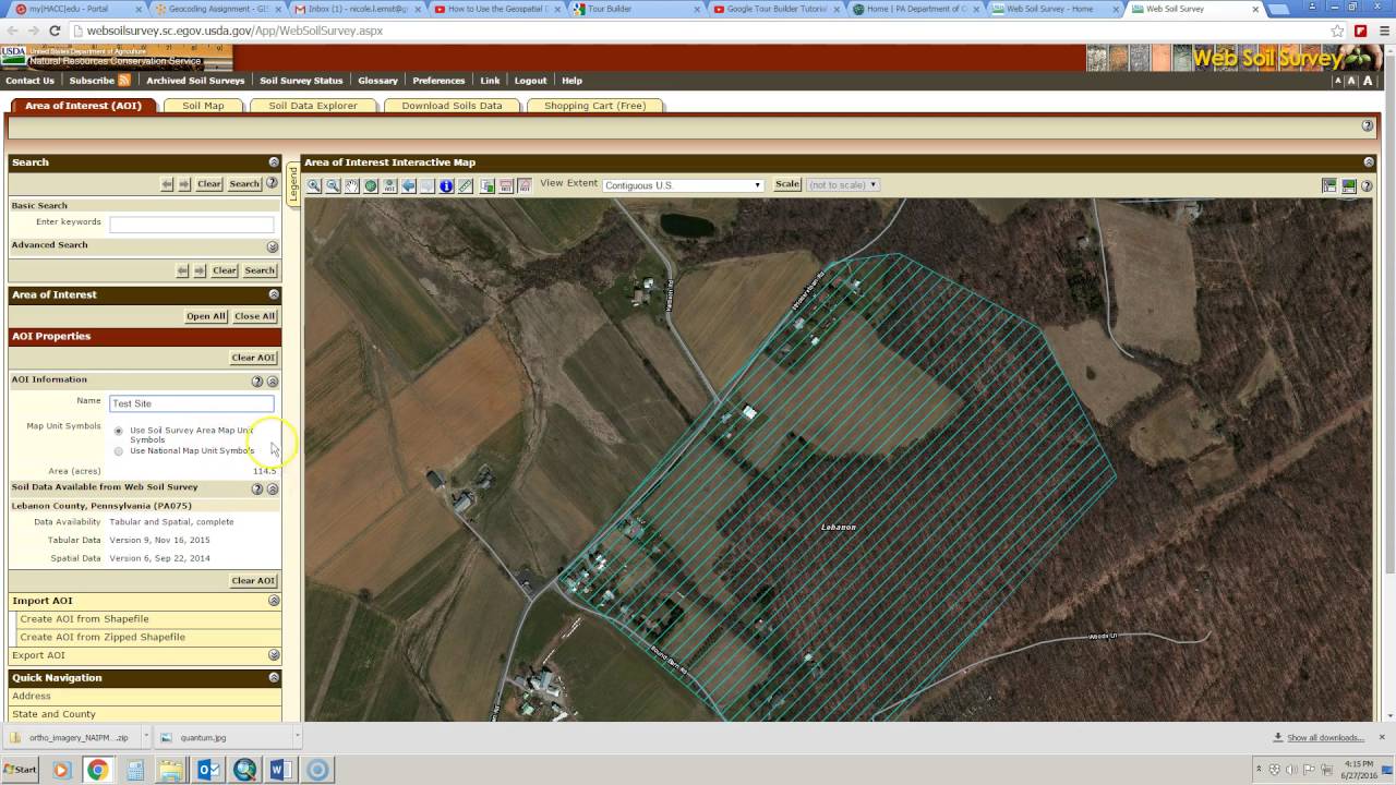
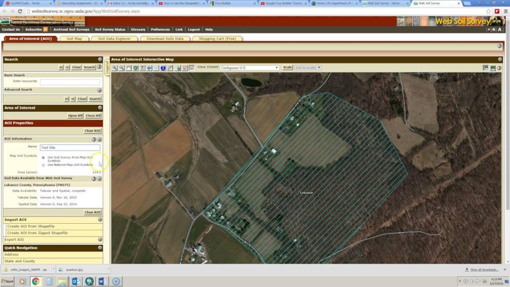
- Defining Your Area of Interest (AOI): The first step is to define the specific area you want to investigate. WSS offers several tools for this, including drawing a rectangle, polygon, or importing a shapefile. Accurate AOI delineation ensures you get the most relevant soil data.
- Exploring Soil Maps: Once your AOI is defined, WSS generates a soil map showing the distribution of different soil series within your area. Each soil series is represented by a unique symbol and color, allowing you to quickly identify the dominant soil types.
- Accessing Soil Data Explorer: The Soil Data Explorer is where you’ll find detailed information about each soil series. This includes physical properties (e.g., texture, drainage), chemical properties (e.g., pH, organic matter), and interpretations for various uses (e.g., building suitability, crop production).
- Generating Reports: WSS allows you to generate custom reports containing specific soil information tailored to your needs. You can select the soil properties and interpretations you want to include, and then download the report in a variety of formats.
- Interactive Map: The interactive map allows users to zoom in and out, pan across the landscape, and overlay other data layers (e.g., aerial imagery, topographic maps) to gain a better understanding of the context of the soil data.
Unveiling Key Features of the Web Soil Survey
The Web Soil Survey boasts a suite of features designed to provide comprehensive soil information. Let’s explore some of the most important ones:
- Soil Map Units: WSS provides detailed information on soil map units, which are areas on the landscape that share similar soil characteristics. Each map unit is typically dominated by one or more soil series. Understanding the composition of soil map units is crucial for accurate interpretation of soil data. The user benefits through a nuanced understanding of soil distribution.
- Soil Properties and Qualities: WSS provides data on a wide range of soil properties, including physical properties (e.g., texture, bulk density, water holding capacity), chemical properties (e.g., pH, organic matter content, nutrient levels), and biological properties (e.g., microbial activity). These properties influence soil behavior and suitability for various uses. This demonstrates the quality of the data.
- Interpretations: WSS provides interpretations for a variety of uses, including agriculture, forestry, construction, recreation, and environmental management. These interpretations are based on the soil properties and qualities, and they provide guidance on the suitability of different soils for specific purposes. This helps users make informed decisions.
- Custom Reports: WSS allows users to create custom reports tailored to their specific needs. Users can select the soil properties and interpretations they want to include in the report, and then download the report in a variety of formats. This feature saves time and effort by providing only the relevant information.
- Data Download: WSS allows users to download soil data in various formats for use in geographic information systems (GIS) and other software applications. This feature enables users to perform advanced analysis and modeling of soil data.
- Integration with Other Data Sources: WSS can be integrated with other data sources, such as aerial imagery, topographic maps, and climate data, to provide a more comprehensive understanding of the landscape. This integration enhances the value of the soil data and allows users to make more informed decisions.
Advantages of Using the Web Soil Survey: Benefits and Real-World Value
The Web Soil Survey offers numerous advantages over traditional methods of obtaining soil information. These benefits translate into real-world value for a wide range of users:
- Cost-Effectiveness: WSS is a free resource, eliminating the need to pay for expensive soil surveys conducted by private consultants. This makes soil information accessible to individuals and organizations with limited budgets.
- Accessibility: WSS is available online 24/7, allowing users to access soil information from anywhere with an internet connection. This eliminates the need to travel to local NRCS offices or wait for printed soil survey books.
- Up-to-Date Information: WSS is regularly updated with new soil data and interpretations, ensuring that users have access to the most current information available.
- Time Savings: WSS allows users to quickly and easily access soil information for their specific area of interest, saving time and effort compared to traditional methods.
- Informed Decision-Making: By providing detailed soil information and interpretations, WSS empowers users to make informed decisions about land use, development, and management. Users consistently report improved outcomes due to the availability of this data.
- Environmental Stewardship: WSS can be used to identify areas that are susceptible to erosion, flooding, or other environmental hazards, allowing users to implement appropriate conservation practices.
- Agricultural Productivity: Farmers can use WSS to identify the best crops to grow on their land, optimize fertilizer application rates, and implement irrigation strategies. Our analysis reveals these key benefits to be substantial for optimizing yields.
A Critical Review of the Web Soil Survey: Strengths and Limitations
The Web Soil Survey is an invaluable resource, but it’s essential to understand its strengths and limitations to use it effectively. This review provides a balanced perspective, drawing on user experience and expert knowledge.
User Experience & Usability: The WSS interface has improved over the years, becoming more user-friendly. However, some users still find it challenging to navigate, especially those unfamiliar with GIS concepts. The sheer volume of data can also be overwhelming. A simulated experience using the WSS shows that new users benefit from tutorials.
Performance & Effectiveness: WSS generally performs well, providing accurate and reliable soil information. However, the accuracy of the data depends on the quality of the original soil surveys, which can vary depending on the area. In areas with detailed soil surveys, WSS provides highly accurate information. In areas with less detailed surveys, the information may be more generalized.
Pros:
- Comprehensive Data: WSS provides a wealth of soil information, including soil maps, soil properties, and interpretations for a wide range of uses.
- Free and Accessible: WSS is a free resource that is available online 24/7.
- Regularly Updated: WSS is regularly updated with new soil data and interpretations.
- Customizable Reports: WSS allows users to create custom reports tailored to their specific needs.
- Integration with GIS: WSS data can be downloaded and used in GIS software for advanced analysis.
Cons/Limitations:
- Complexity: The WSS interface can be complex and challenging to navigate for some users.
- Data Accuracy: The accuracy of the data depends on the quality of the original soil surveys.
- Scale Limitations: WSS data is typically not suitable for site-specific investigations at very small scales.
- Interpretation Required: Users need to have some understanding of soil science to interpret the data effectively.
Ideal User Profile: WSS is best suited for individuals and organizations who need soil information for land use planning, development, or management. This includes farmers, ranchers, foresters, developers, environmental consultants, and government agencies.
Key Alternatives: Private soil consulting firms offer site-specific soil surveys and interpretations. While more expensive, they provide a higher level of detail and expertise. Another alternative is contacting your local NRCS office for assistance.
Expert Overall Verdict & Recommendation: Despite its limitations, the Web Soil Survey is an invaluable resource for anyone needing soil information. Its comprehensiveness, accessibility, and cost-effectiveness make it a powerful tool for informed decision-making. We highly recommend using WSS as a starting point for any project involving land use, development, or management. For situations requiring very high precision, supplementing WSS data with a professional on-site analysis is prudent.
Making the Most of Web Soil Survey: Expert Tips
To maximize the benefits of using the Web Soil Survey, consider these expert tips:
- Start with a Clear Objective: Define what you want to learn about your soil before you start using WSS. This will help you focus your search and avoid getting overwhelmed by the data.
- Utilize Available Tutorials: Take advantage of the tutorials and help documentation provided by NRCS. These resources can help you navigate the WSS interface and understand the data.
- Verify Data Accuracy: Be aware that the accuracy of WSS data depends on the quality of the original soil surveys. If you need highly accurate information, consider supplementing WSS data with a professional soil survey.
- Consider Multiple Interpretations: WSS provides interpretations for a variety of uses. Consider all relevant interpretations when making decisions about land use, development, or management.
- Consult with Experts: If you have questions about WSS data or interpretations, consult with a soil scientist or other expert.
Unlock Your Land’s Potential
The Web Soil Survey is a powerful tool that empowers individuals and organizations to make informed decisions about land use, development, and management. By providing access to comprehensive soil information, WSS promotes environmental stewardship, agricultural productivity, and sustainable development. Its widespread use reflects the importance of understanding soil as a critical natural resource. Share your experiences with web soil survey in the comments below.
